
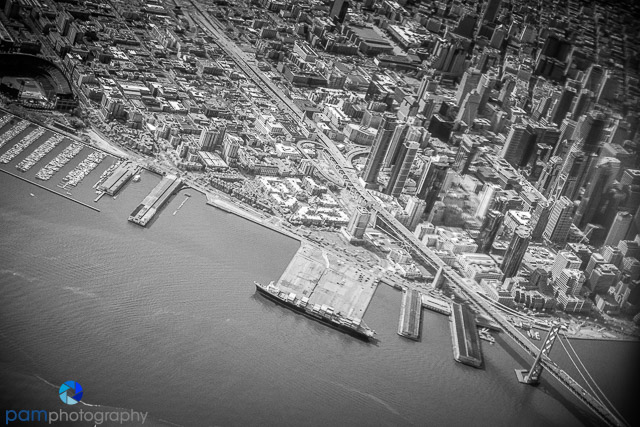

A while back, a photographer friend, Ron Black, showed us his infrared photos from an airplane. They were really cool. We were hooked. Now, when we get a chance, we try to get a window seat and pull our cameras. Here are a few from a flight from Oakland to Ontario.

First, you have to have the right seat knowing where your subjects might be. I fly up and back to Oakland a lot, so I know if you are on the right side of the plane, you will get a good view of the San Francisco Bay and City, but then there is not much else as you fly down the coast. On the left side of the plane, you will get a view of Oakland, San Jose, and the Central Valley as you fly South.

So, you are looking for a few things – interesting landmarks, building, etc. As you enter the central valley, you are looking for patterns in the sky or on the ground.

Be careful of reflections in the airplane window and dirty and scratched windows.

These photo were made with a Sony RX 100 Mark II converted to infrared by LifePixel. I processed the infrared files in Silver Effects Pro by Google (used to be Nik).


What do you think?
Mary has three other original blog posts about this technique. Just type in “airplane” in the search box at the top of the page.
To see more of (and buy) our photographs, please go to www.pamphotography.com.


Leave a comment