

When most people think of Glacier National Park, they are thinking about the Going-to-the-Sun Road or this is what they have seen of the park in photographs. From the St. Mary park entrance in the east to the Apgar park entrance in the west, the Going-to-the-Sun road runs 48 miles and is a 90 minute drive without stopping, but of course, you will be stopping…often. Here are some of the highlights east of the Logan Pass Visitor Center which is at the top of the road.
We stayed at the Rising Sun Motor Lodge near the St. Mary entrance which had cute cabins and lots of room to spread out. Food was becoming more of an issue as the restaurants in St. Mary were open sporadically. We finally succumbed to picnic food from our cooler for several meals.
Before taking off on the Going-to-the-Sun Road, make a stop at the Visitor Center and check out the south side of Saint Mary Lake. There is a trail head at Red Eagle and Beaver Pond. Not many people make it to this area and it is worth an hour hike to look around. Know that the National Park Service has instituted a reservation system for all cars entering the park. Even if you are not staying in the park, you need a reservation just to drive in. See the National Park Service website for more information.


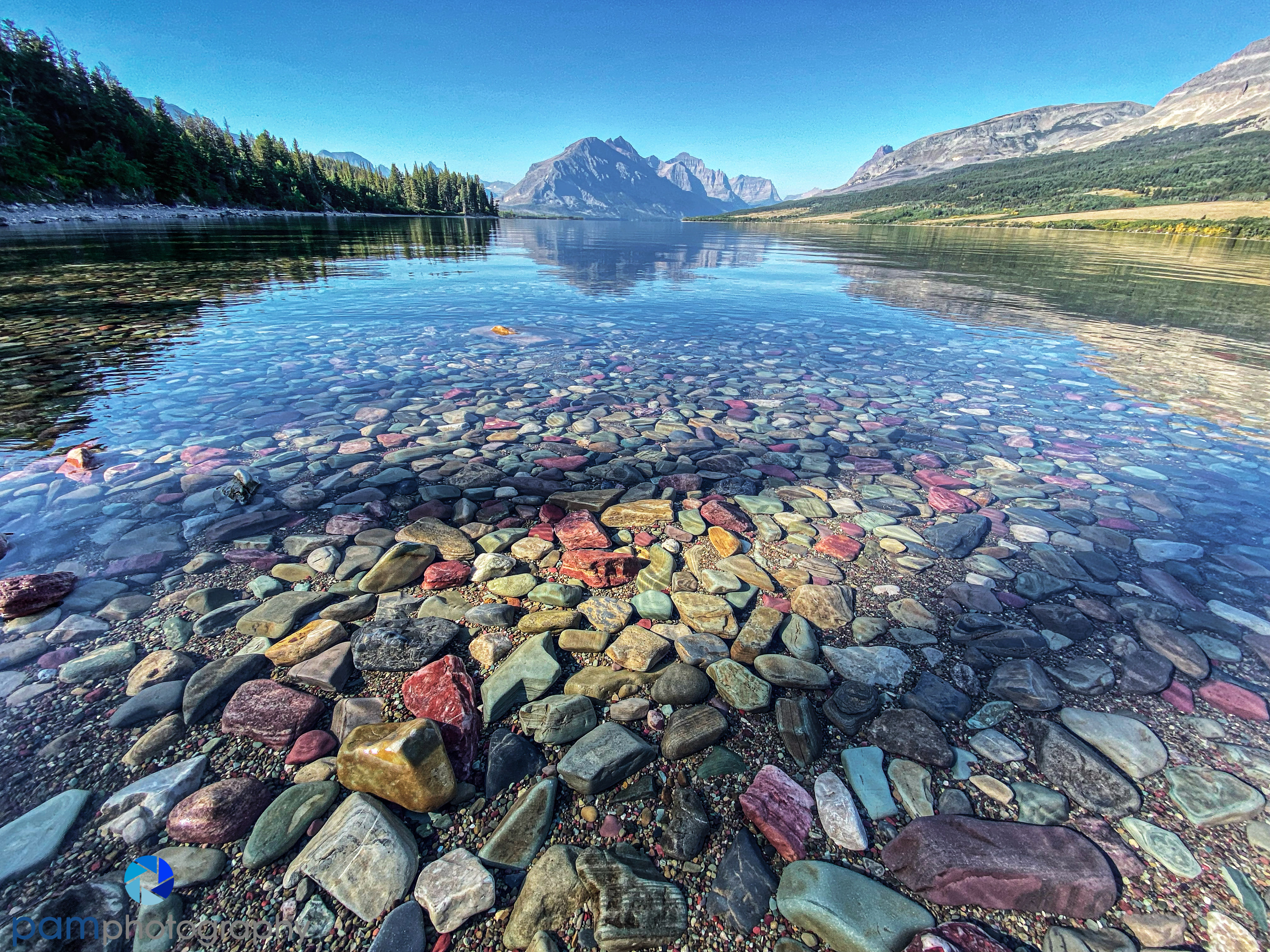
Driving west, the first attraction along the road is Wild Goose Island in Saint Mary Lake and the surrounding mountains. This is a popular stop, but there is ample parking here. Most people will walk to the open space in the trees at the top of the road and make a quick snapshot with their phone and move along. I would encourage you to wander down the slop a bit and go to the left to get a better composition of the island and the lake. We stopped here numerous times and had a good sunrise shoot.
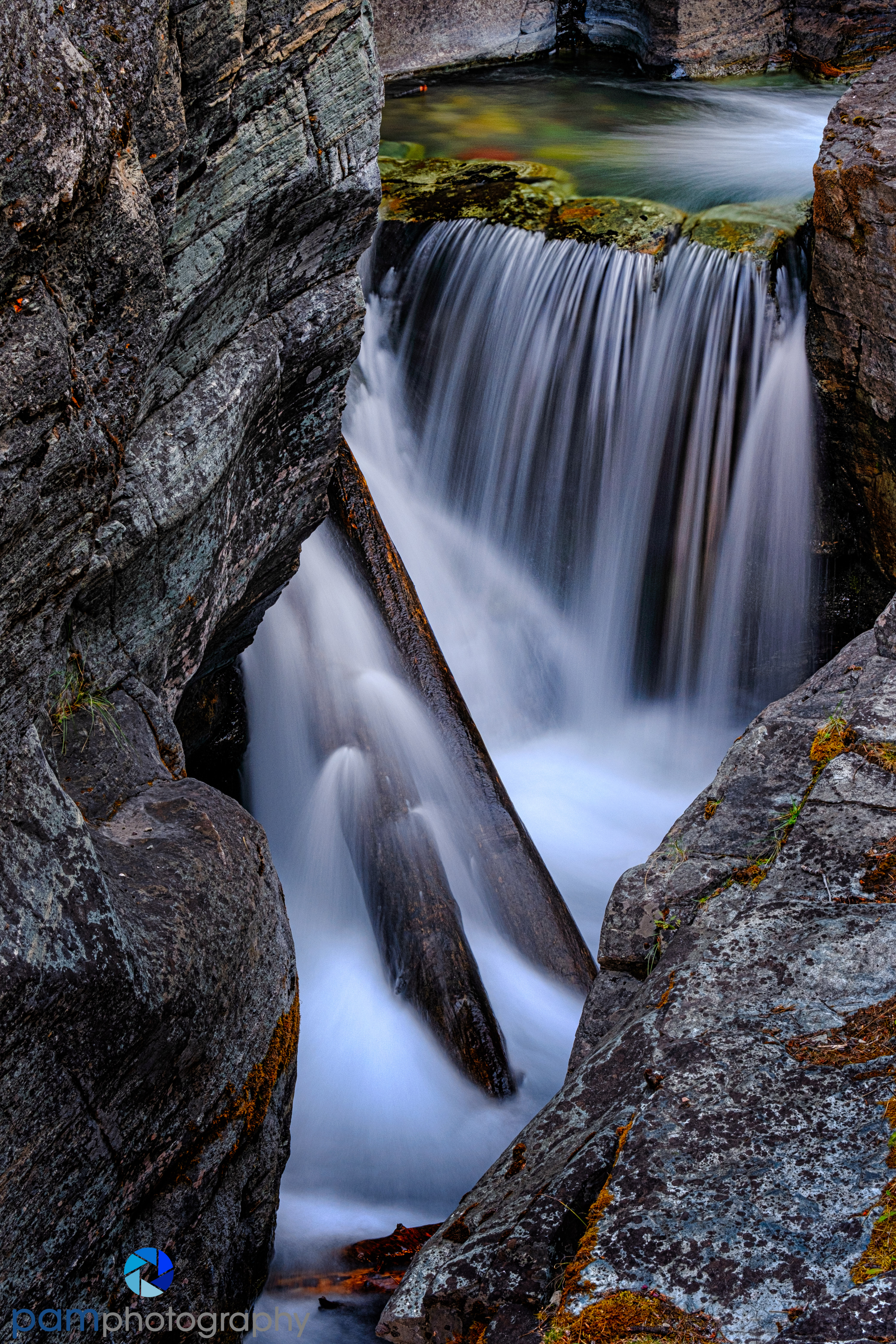
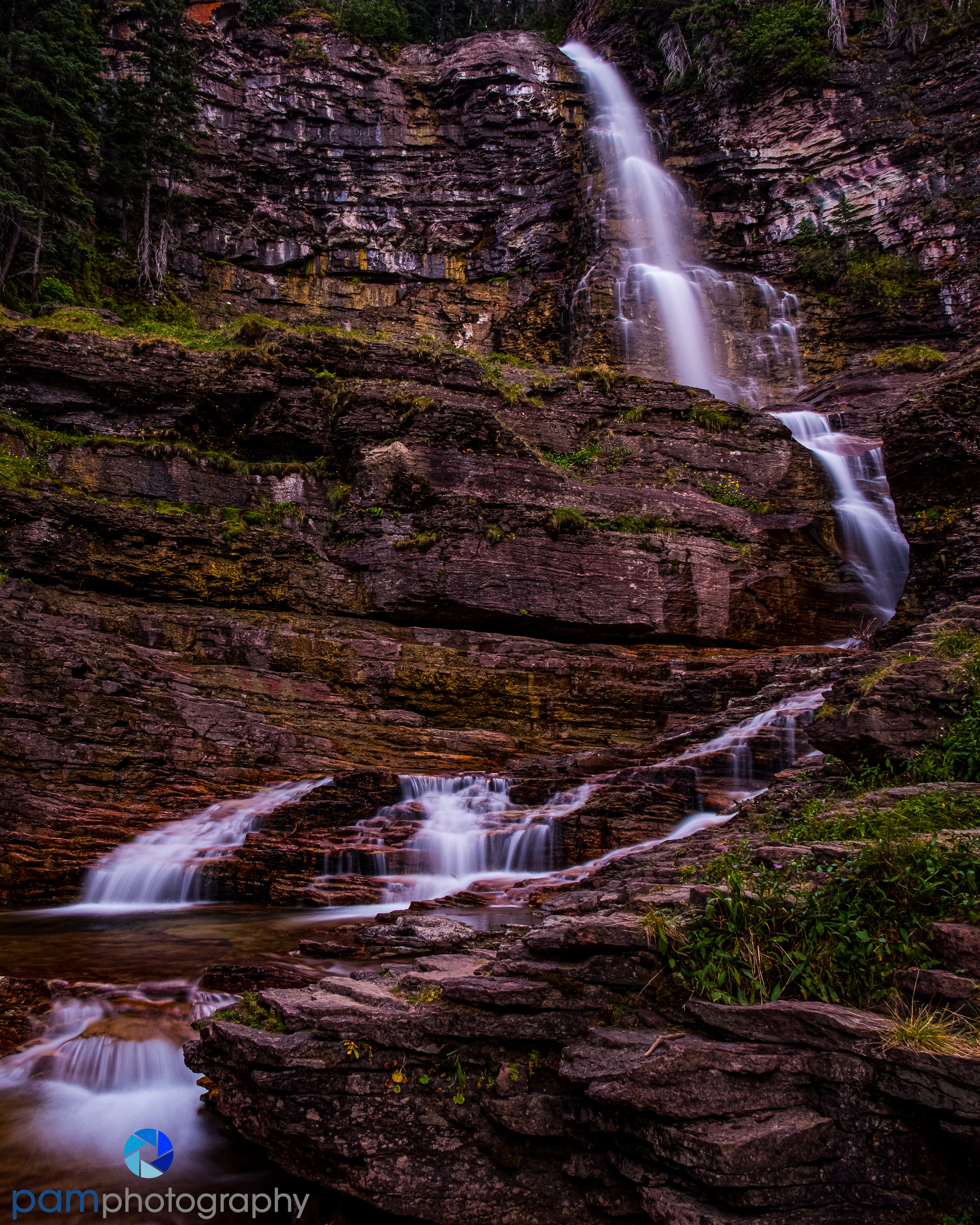
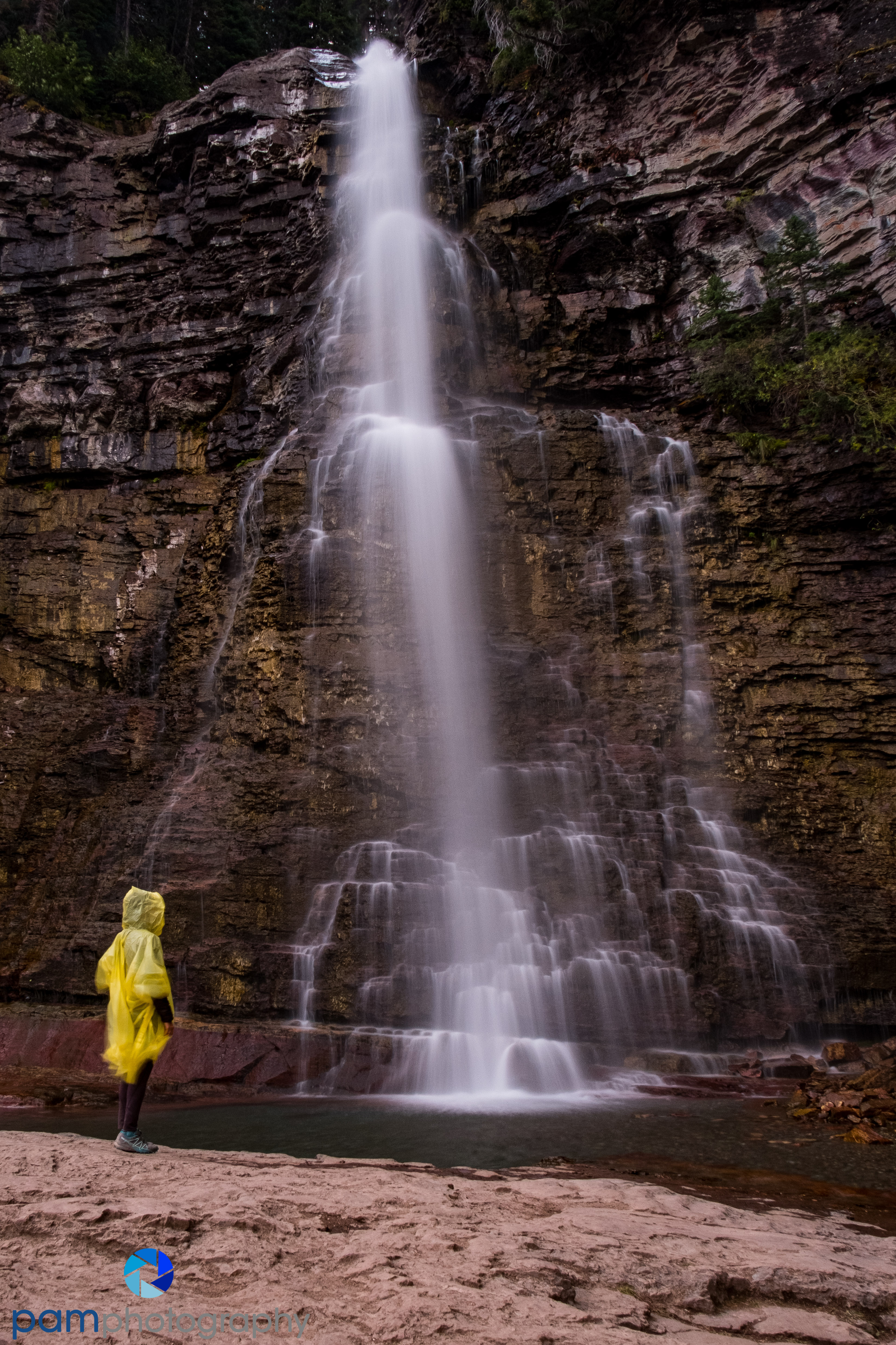
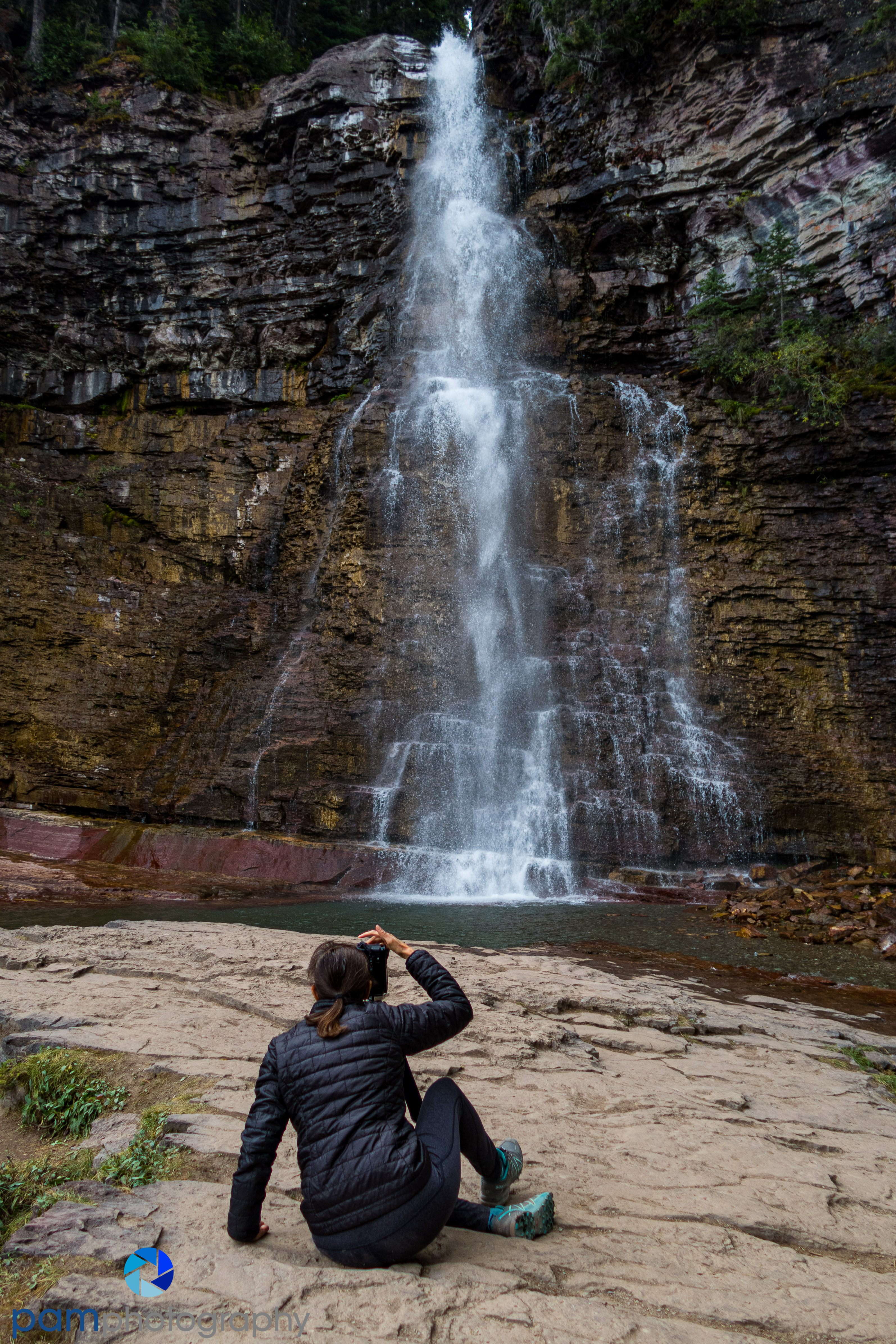
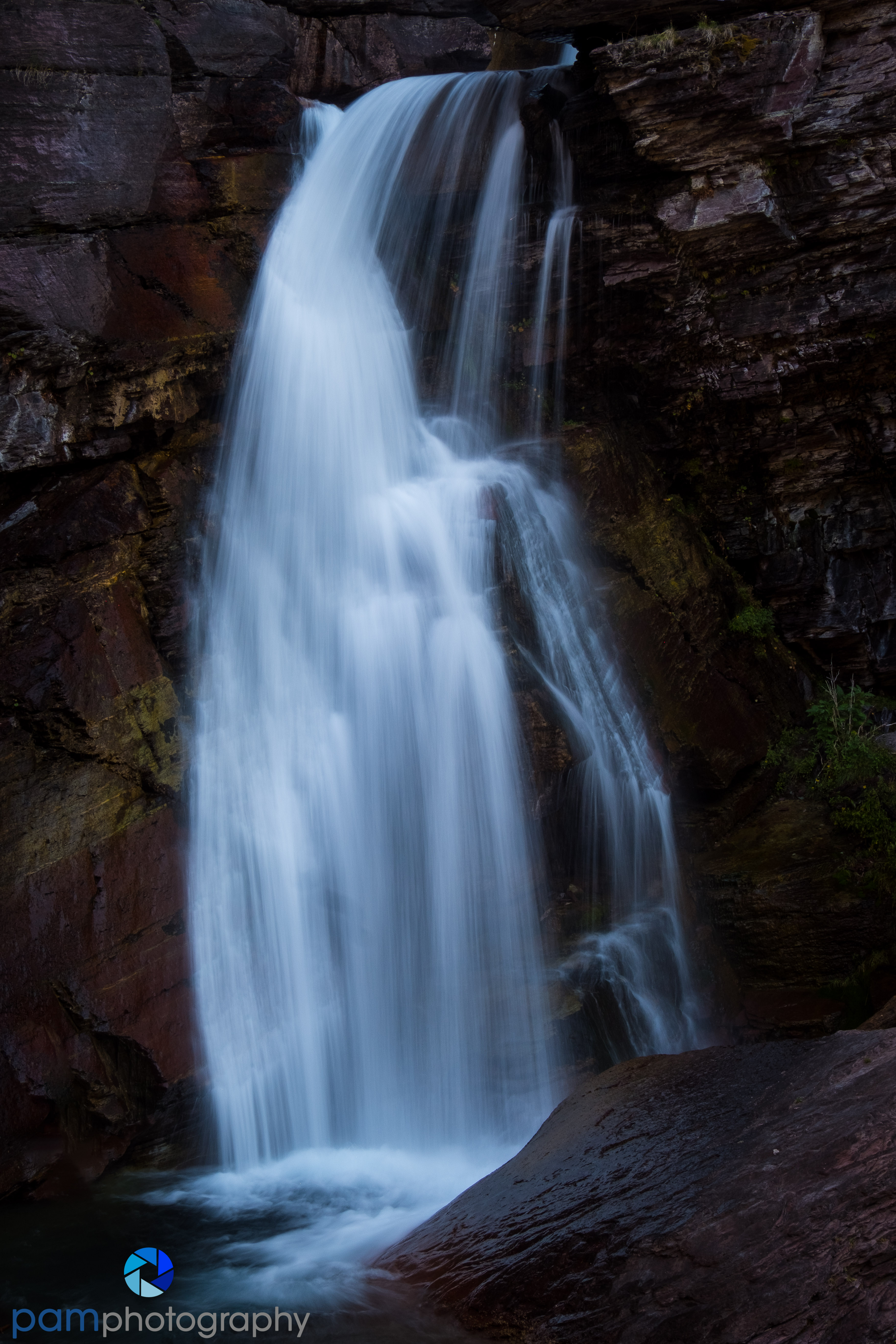
Our favorite location on this side of the Park was St. Mary and Virginia Falls. If this is all you can see in one day, then go see these falls. And you can stretch out the hike a bit and also see Sunrift Gorge and Barring Falls. You may not have a choice as the parking area for St. Mary Falls only has ten parking spots. The parking lot for Sunrift Gorge has a few more than that. Worse case is you are parking at Sun Point which will add 2-4 miles to your hike and even this lot gets full pretty quickly. Regardless, you will be walking…a lot.

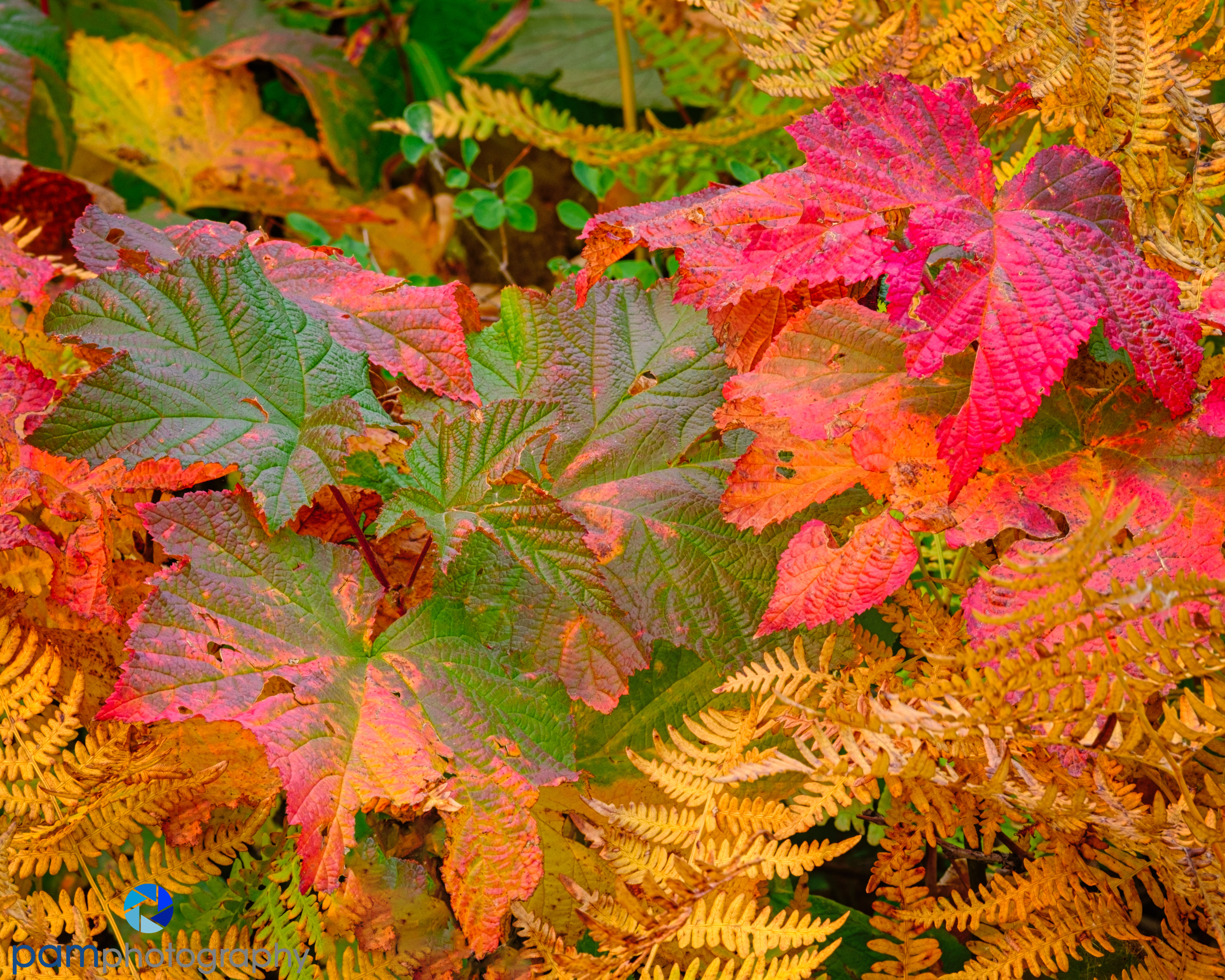
The hike from Sunrift Gorge to Virginia Falls is a 4.5 mile round trip and will take 2-3 hours depending on how long you spend at each waterfall. Mary and I brought our lunches and spent a good three hours hiking and making photos. And it’s not just the named waterfalls, but there are numerous un-named cascades and falls that are very pretty. Mary also fell in love with the many colorful ferns along the trail.


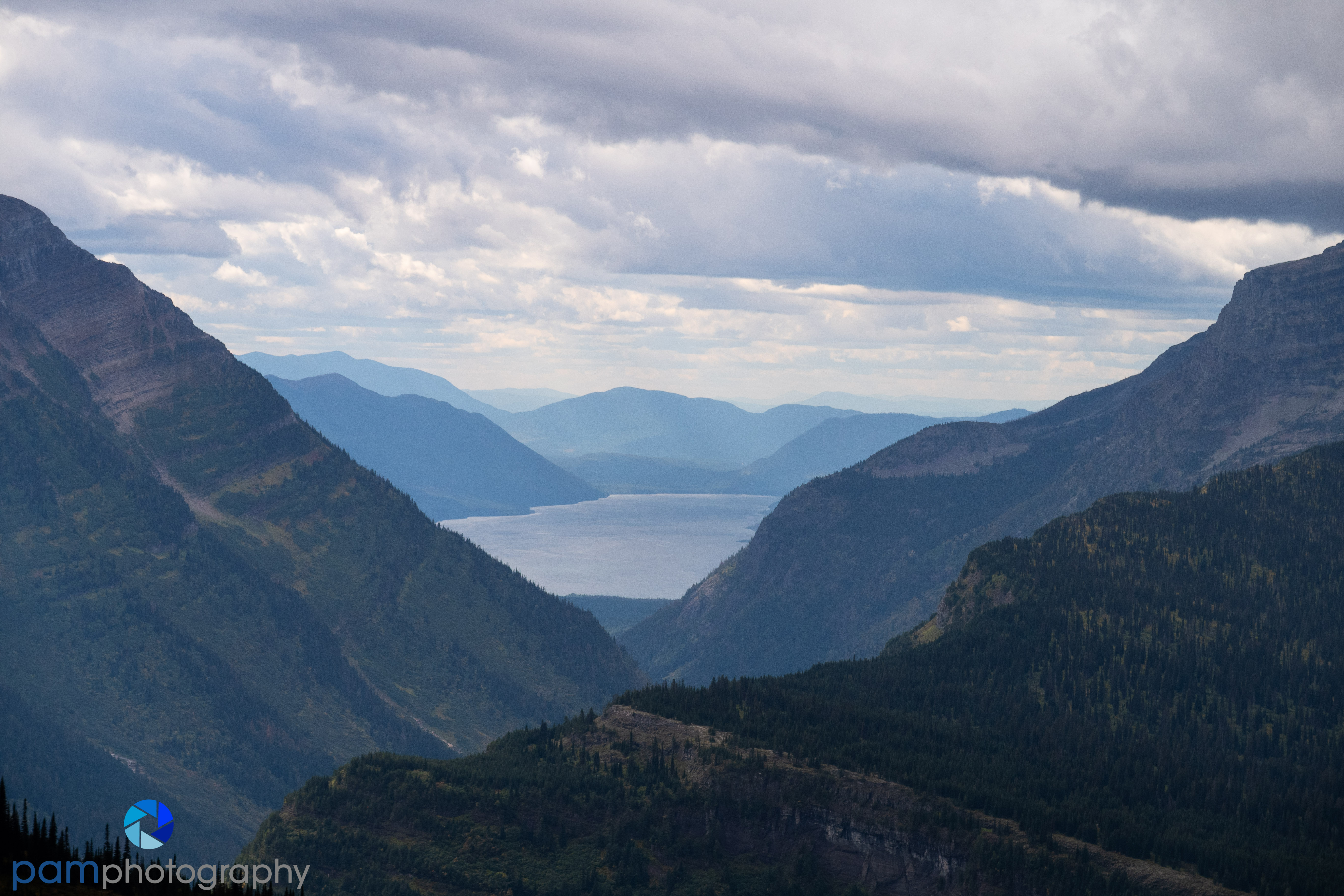
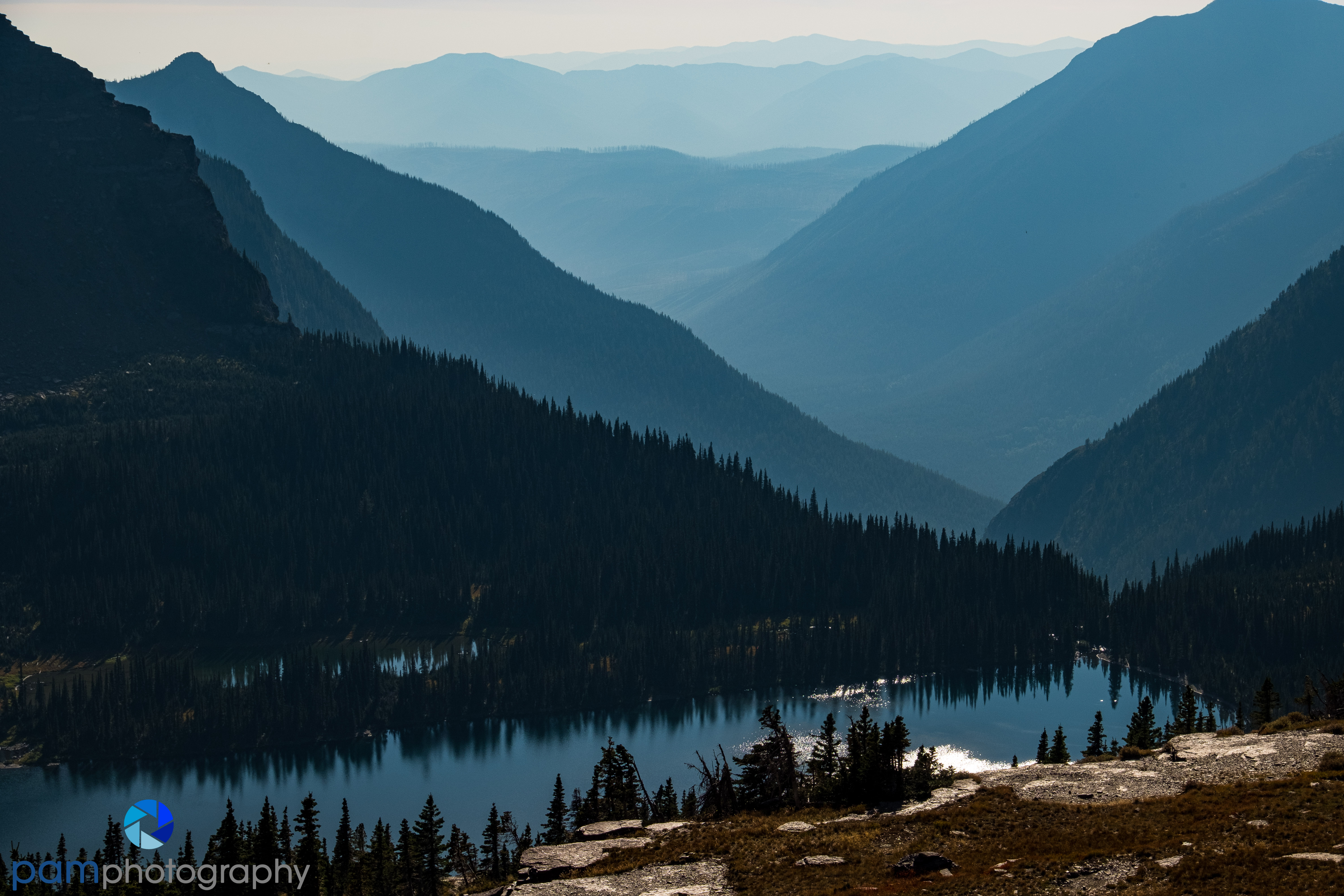
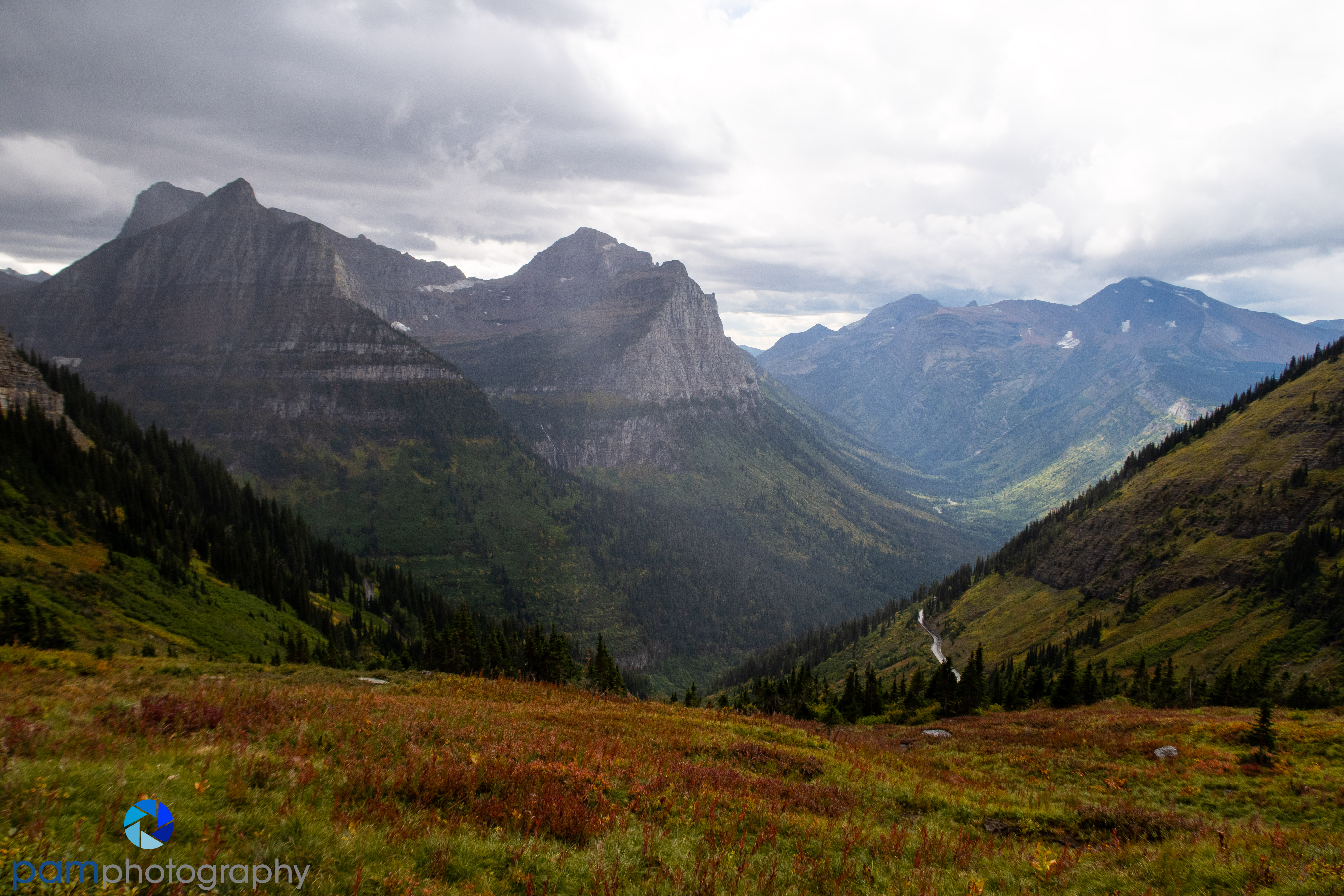
Driving north now, the road narrows and climbs into Glacier proper with steep towering mountains on all sides and a deep valley below the road. The next stop is the Logan Pass Visitor Center. Even with a car reservation system, this area is packed. You have two choices with this area. You either need to be in the Visitor Center parking lot before 7 AM or you need to hope you can get into it in the late afternoon after 3 PM. The rest of the day, it is full and mostly closed by the rangers.
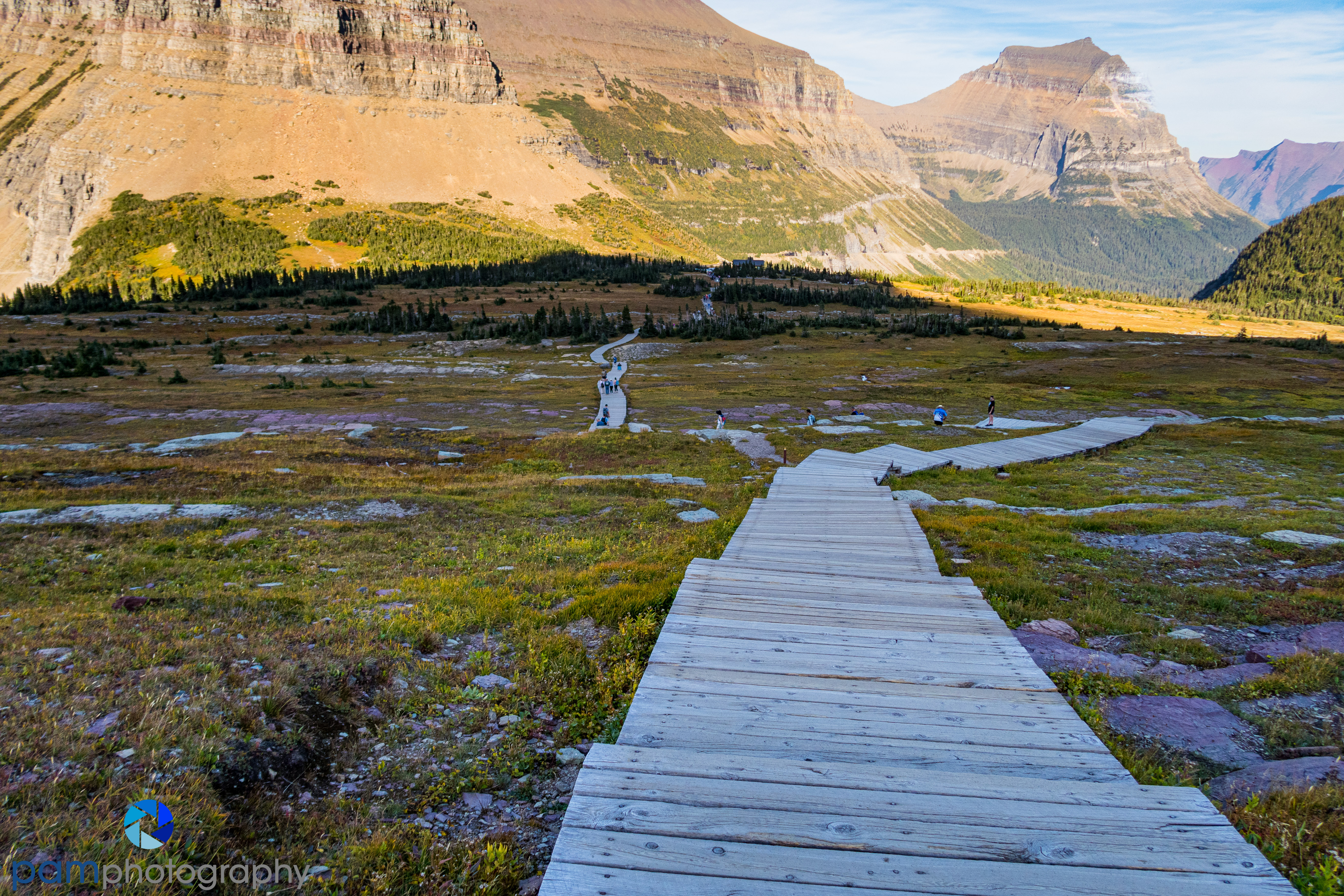
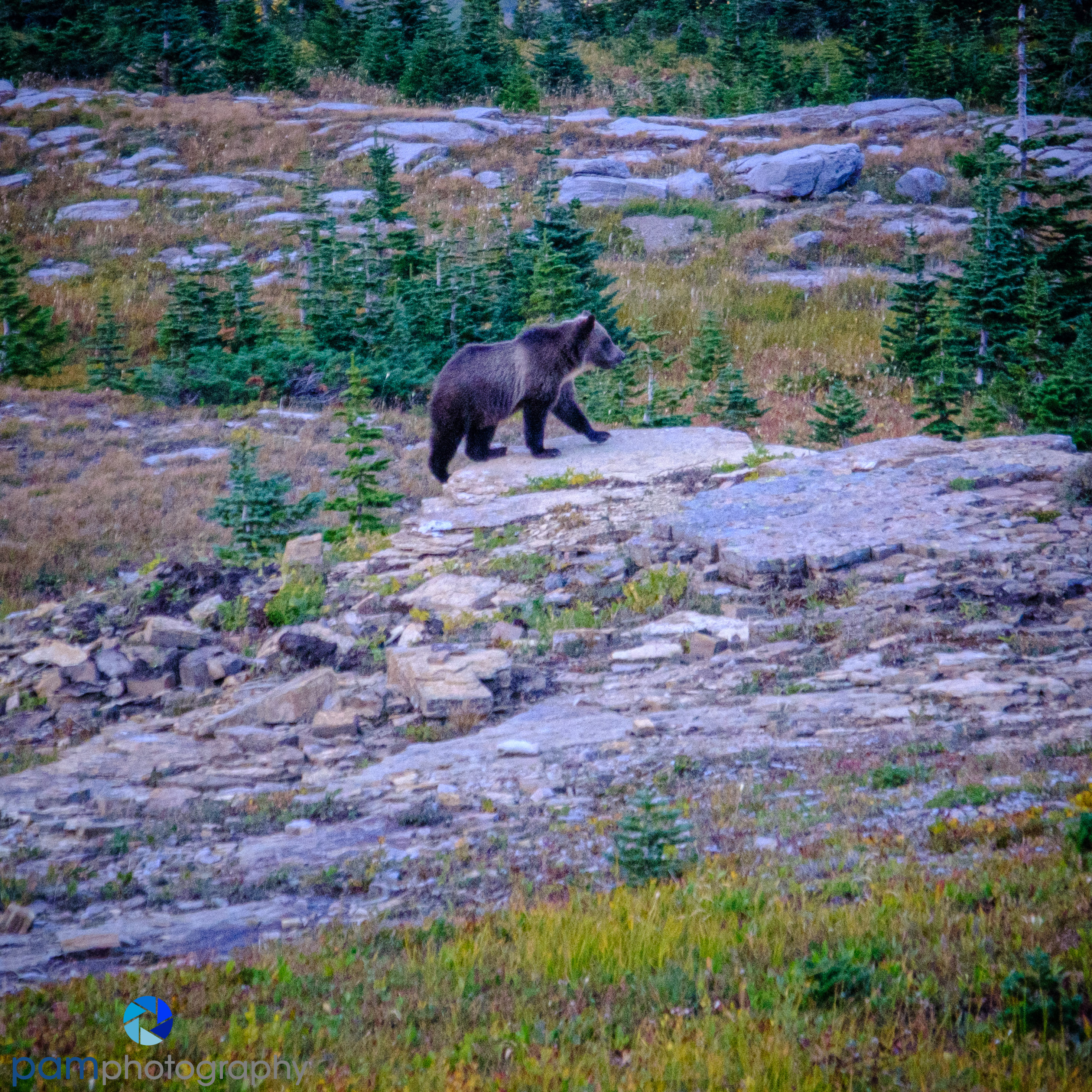
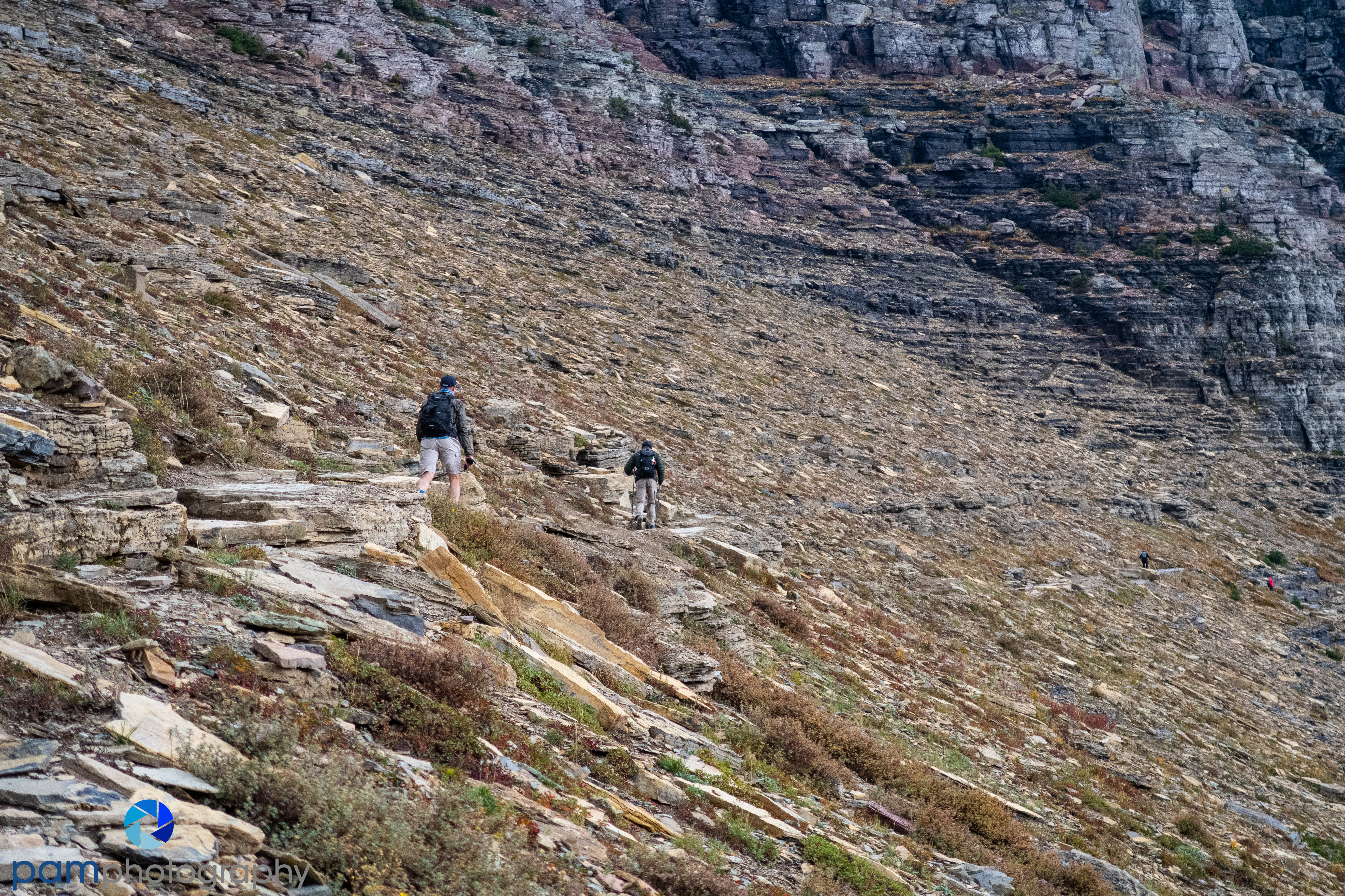
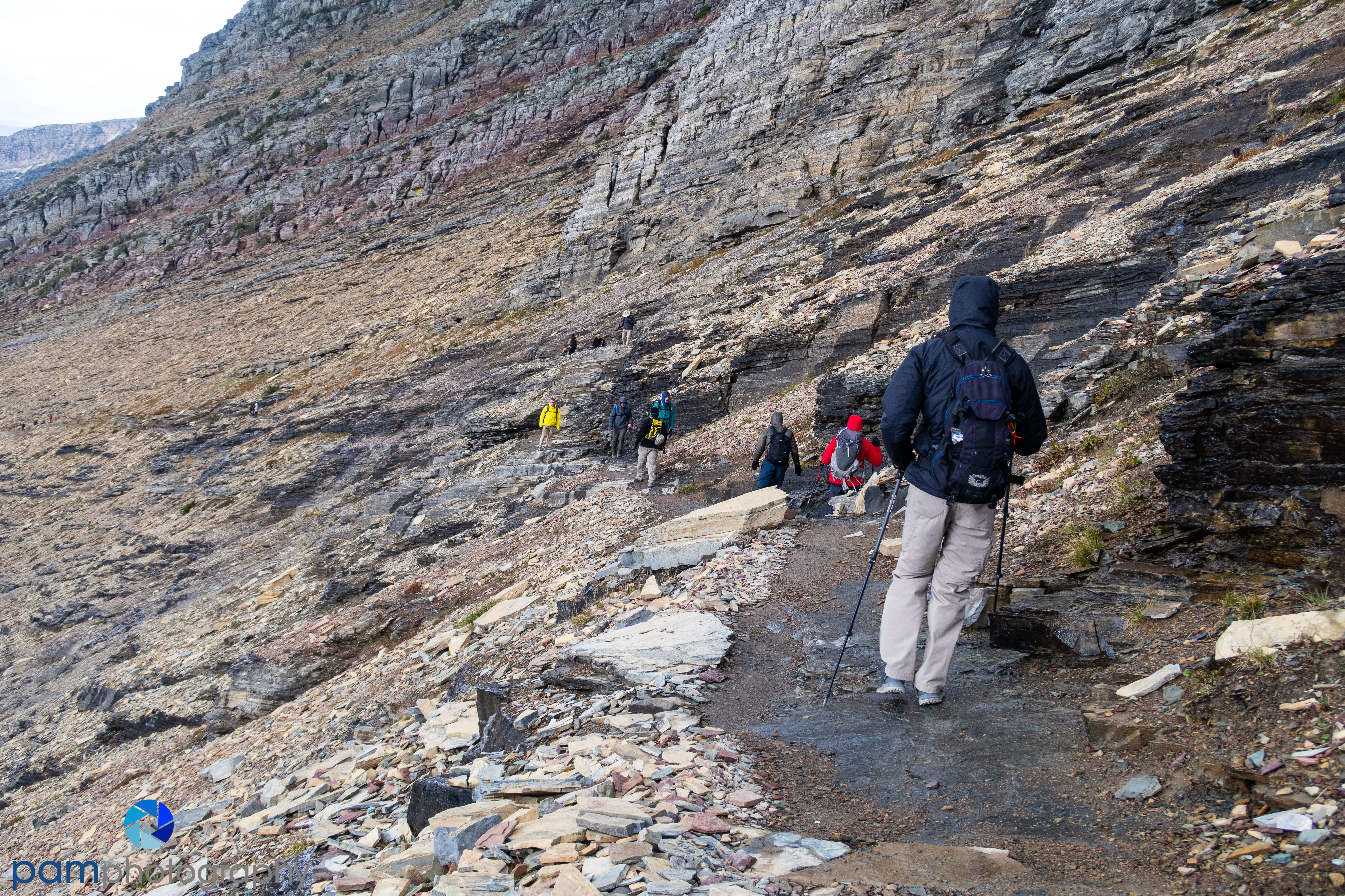
The two attractions up here are the hike to Hidden Lake and the Highline Trail. The Hidden Lake trail starts behind the Visitor Center and the Hidden Like Overlook is just 1.5 miles away. This popular trail had been closed on-and-off for months because of bear activity. The trail down to the lake was closed for the season for the same reason. Well, we lucked out because as we were heading back, a momma grizzly and her two cubs were close enough for some photos. After the ranger cleared the trail, they closed it for the rest of the season.
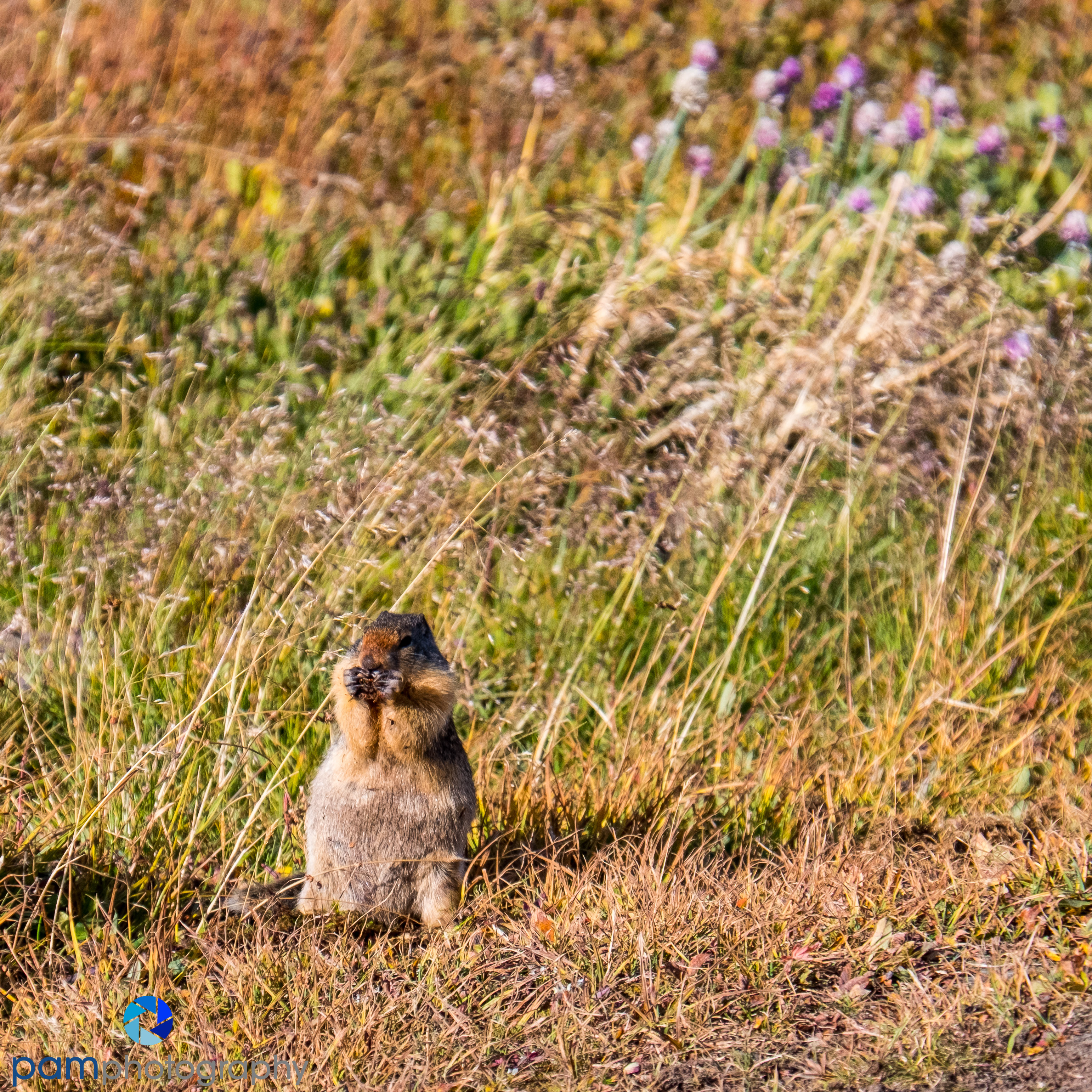
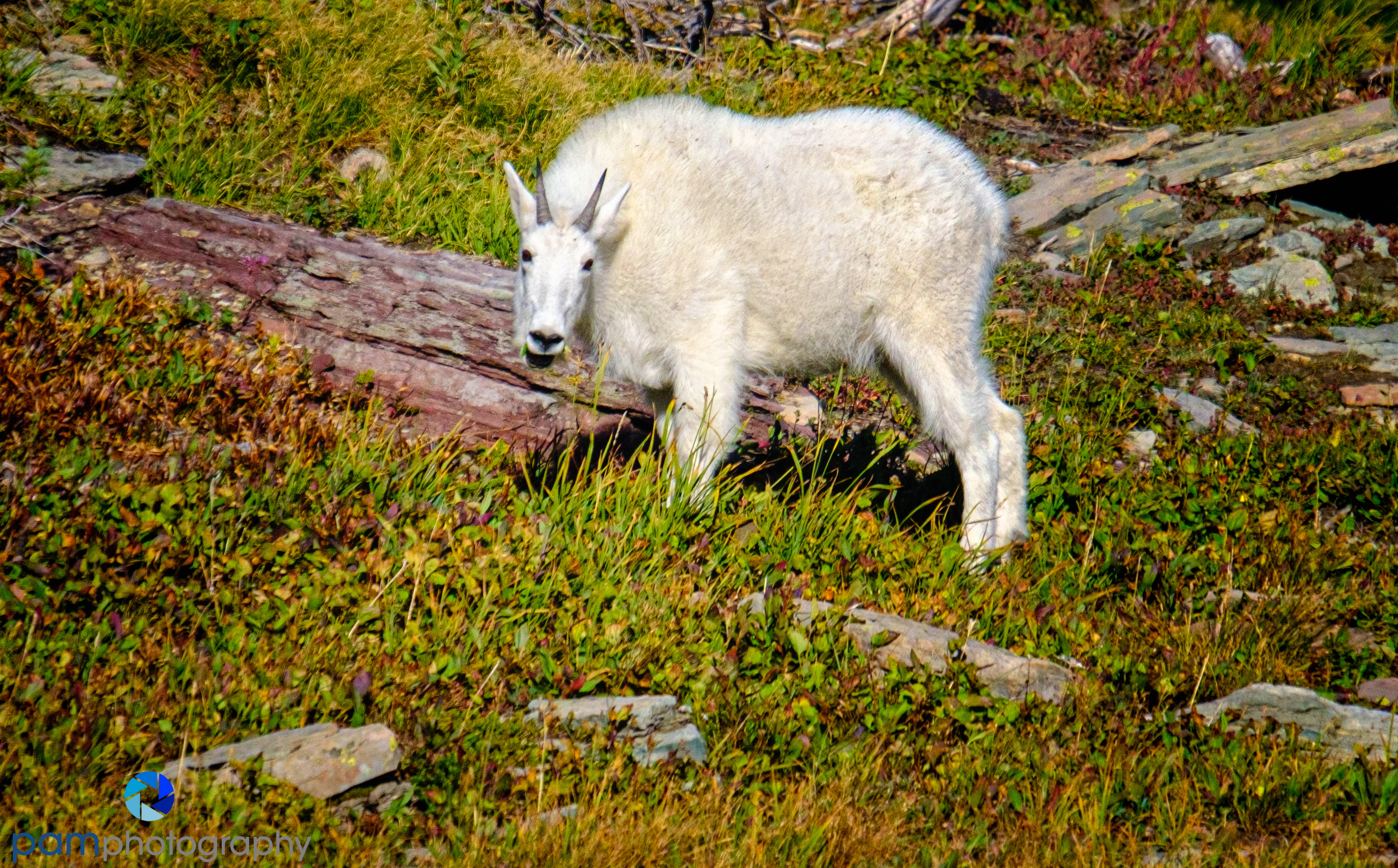
Even before the bears sighting we had a close encounter with a mountain goat and marmot. It was quite an eventful 1.5 miles.


The week after Mary and I were here, I hiked the Highline Trail with college buddies all the way to the Grinnell Glacier Overlook. This is a 16 mile round trip with 1,700 feet of elevation gain. The last mile was 1,000 feet straight up and was the hardest mile I have ever experienced. We had 50 miles an hour wind near the top; it rained on us, and it snowed on us, but it was worth it.


Next time, down the hill to Lake McDonald and our last stop in Glacier National Park.
To see more of and buy our photographs, please go to www.pamphotography.com and check out more of our photos on FLICKR.

Leave a comment