

Mary and I spent Christmas week in Big Sur in 2012 and 2013. In 2012, it rained heavily and CA Highway 1 washed out near McWay Falls and we were not able to drive south out of Big Sur. In 2013, we had drought conditions and 70+ degree days. We finally got to drive south, twice. Here are some of the best views of the southern Big Sur coastline.


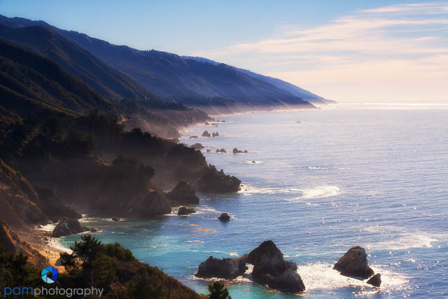
The turnout at Mile Marker 37 is one of the iconic shots of the southern coast. Not only is the view a “long one”, but it also has the arch in the foreground, as well as a number of trees. You can use a short telephoto lens here to create many different compositions.

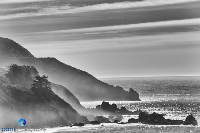
The turn out at mile marker 30 is known as the “Coastal Range View”. You can shoot both north and south. Again, we used our 70-200 mm telephoto lenses and infrared cameras, here.
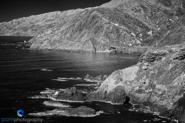
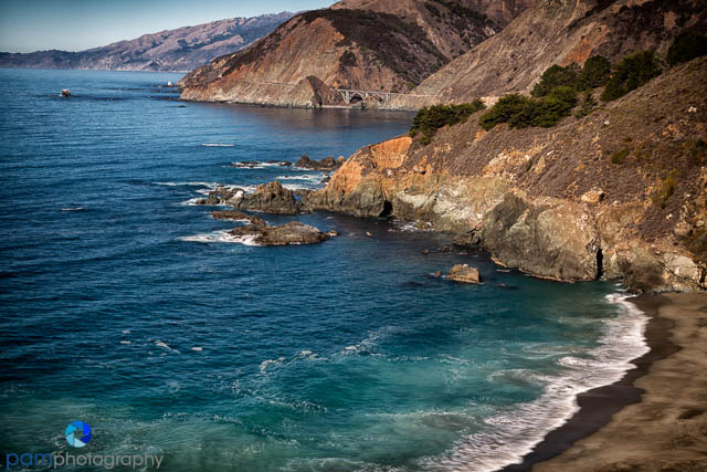
As you drive south, the next great subject is the Big Creek bridge. We were there mid-morning, so parking south of the bridge allowed us to have the sun over our shoulders and photograph facing north. There is also a great view from Gamboa Point a little further south..


There is a ton of paupas grass all along the highway as you drive south. We stopped a few times to make some of these types of photos.

Our final stop on our drive south is the famous lookout from Nacimiento Road. There are actually two turnouts, one that is just up the mountain on Nacimiento Road and one that is on CA Highway 1 just south of Nacimiento Road. They are both good compositions looking south.


The California coast line north and south of Big Sur is some of the most beautiful landscape in the world. If you have never had a chance to drive this spectacular road, do it. There is a new and surprising view every few miles.
We used the following guides. Photographing Big Sur by Douglas Steakley and The Photographer’s Guide to the Big Sur Coast by Don Smith.
See our other blogs on Big Sur including the north coast, McWay Falls, the Pfeiffer Beach Arch, and other locations.
To see more of (and purchase) our photos, please go to www.pamphotography.com.

Leave a comment